Pottsville, New South Wales
| Pottsville New South Wales | |
|---|---|
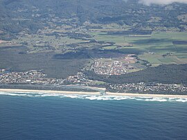
 Aerial photograph of Pottsville in 2007 | |
| Coordinates | 28°23′S 153°34′E / 28.383°S 153.567°E |
| Population | 7,209 (2021 census)[1] |
| Postcode(s) | 2489[2] |
| LGA(s) | Tweed Shire |
| Region | Northern Rivers |
Pottsville is a town in the Northern Rivers region of New South Wales, Australia in Tweed Shire. At the 2021 Census, Pottsville had a population of 7,209.[1] Bill Potts owned the first house in Pottsville around and the location was initially named Potts Point. Soon though, the town was renamed Pottsville to alleviate any confusion with the place of the same name in Sydney.
Pottsville includes housing developments such as Pottsville Waters, Koala Beach, Seabreeze and Black Rocks Estate.
Pottsville is also home to Pottsville Beach Public School[3] & St Ambrose Primary School.[4]
History
[edit]Pottsville, originally a tea tree swamp, originates from Bill Potts, an individual resident who owned the first home in 1930. Its name was changed in order to avoid confusion with Potts Point, a suburb of Sydney CBD.
In the 2021 census, Pottsville had a total population of 7,209.
Today, Pottsville has transformed into a quiet coastal town and is popular for its recreational beaches and holiday accommodations.
| Year | Pop. | ±% |
|---|---|---|
| 1971 | 245 | — |
| 1976 | 332 | +35.5% |
| 1981 | 673 | +102.7% |
| 1986 | 621 | −7.7% |
| 1991 | 1,293 | +108.2% |
| 1996 | 1,987 | +53.7% |
| 2001 | 2,576 | +29.6% |
| 2006 | 3,298 | +28.0% |
| 2011 | 5,735 | +73.9% |
| 2016 | 6,550 | +14.2% |
| 2021 | 7,209 | +10.1% |
| Source: Australian Bureau of Statistics data.[5][6] | ||
References
[edit]- ^ a b Australian Bureau of Statistics (22 January 2024). ". 2021 Census QuickStats. Retrieved 22 January 2024.
- ^ Pottsville Postcode Australia Post
- ^ Pottsville Beach Public School
- ^ St Ambrose Primary School
- ^ "Statistics by Catalogue Number". Australian Bureau of Statistics. Retrieved 22 January 2024.
- ^ "Search Census data". Australian Bureau of Statistics. Retrieved 22 January 2024.

